DiveLine LogoDiveLine LogoDiveLine
Blog
⌘K
Sign UpLogin

DiveLine

Your ultimate dive buddy for the perfect underwater experience.

Features

  • Dive Map
  • Dive Areas
  • Dive Planner
  • Blog

Resources

  • Patron
  • Buy Us a Coffee
  • Contact Us

Contact

  • [email protected]
  • +1 (831) 566-8793
  • Laguna Beach, CA, USA

© 2026 DiveLine. All rights reserved.

Privacy PolicyTerms of Service
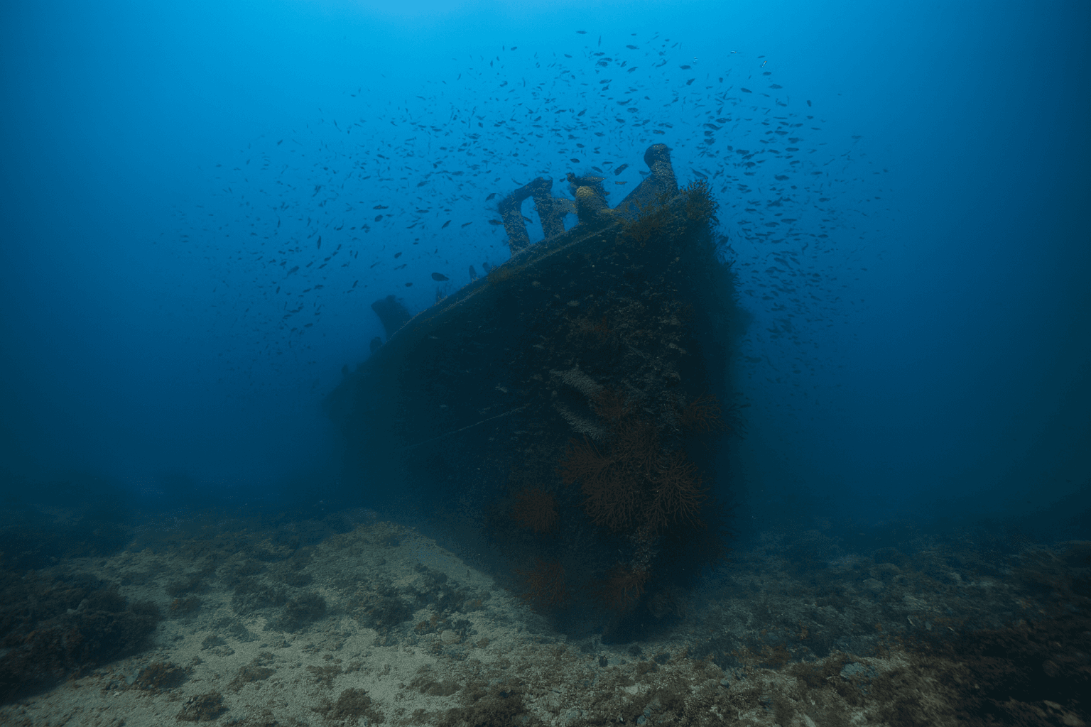
Scuba diving at River Gurara Proa (Bow) in Lisbon Coast
Back

River Gurara Proa (Bow)

GOOD
Lisbon CoastBoat
About This Site
The River Gurara Proa is the signature dive of the whole Lisbon coast and the most-dived wreck in the Sesimbra region. It is the bow half of the MV River Gurara, a roughly 170 m Nigerian cargo ship that suffered engine failure in a February 1989 storm, drifted onto the rocks of Cabo Espichel and broke in two with the loss of crew. The bow section is the deeper of the two Gurara sites, sitting on sand around 28-32 m about a mile off the cape, its hull now draped in colourful gorgonians and worked by large shoals of pelagic fish and resident conger eels. Its depth and exposed position off the open Atlantic make it an advanced wreck for experienced divers and a favourite platform for technical training.

Difficulty

Advanced

Max Depth

30m

Type

Boat

Typical Visibility

9m

Conditions Summary

Best time today

6AM - 12PM

GREAT

Best day in forecast

Friday

GREAT

2026-07-10

Community-reported visibility

n/a

Warnings for today

None

The bow of the River Gurara sits in open water just off the southern/SW-facing tip of Cabo Espichel, the exposed western corner of the Setubal Peninsula. The cape body and the Espichel lighthouse/sanctuary lie close to the N-NNE (bearing ~17deg, ~1 km), and the coast curving east toward Sesimbra shadows the NE through E sectors, so the wreck is well protected on its landward (N-NE-E) side. Its exposure window is the open Atlantic from the SE round through S and SW to W and WNW - a wide arc with no land shelter. Because this is an exposed Atlantic coast, the peak exposure is the W-SW-WSW band, straight into the path of the dominant W-to-WNW Atlantic groundswell. The cape's western promontory projects only to the NNW-NW (bearing ~332deg, ~750 m), so it clips just the NNW-NW sectors and provides no shelter from W or SW swell. As a result a solid W-SW groundswell or a southerly blow drives surface chop and reinforces current over the wreck, closing the dive; only the northerly and easterly quarters are truly sheltered.

NNEESESSWWNW
Protected
Partially Exposed
Exposed
Loading...
Nearby Dive Sites
Rabo de Asno (Donkey's Tail Wall & Tunnel)Primavera WreckPedra da AnixaPedra do Leão (Lion's Rock)ArcanzilRiver Gurara Popa (Stern)